



iPoint
Deployment
Best for
Overview
About iPoint
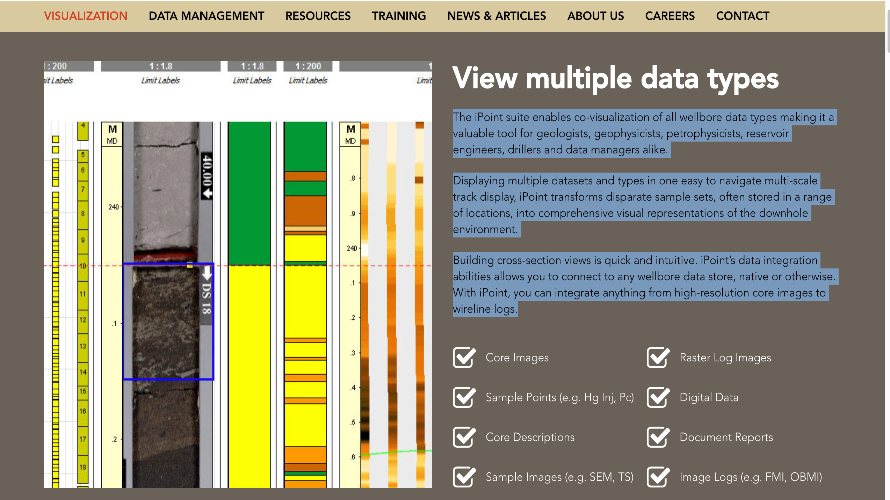
The iPoint suite enables co-visualization of all wellbore data types making it a valuable tool for geologists, geophysicists, petrophysicists, reservoir engineers, drillers and data managers alike.
Displaying multiple datasets and types in one easy to navigate multi-scale track display, iPoint transforms disparate sample sets, often stored in a range of locations, into comprehensive visual representations of the downhole environment.
Building cross-section views is quick and intuitive. iPoint’s data integration abilities allows you to connect to any wellbore data store, native or otherwise. With iPoint, you can integrate anything from high-resolution core images to wireline logs.
At a glance
Software information
Industries served, licensing and the support iPoint provides.
Licensing
- Quote Based
Support
- Phone
- Live Chat
Training
- Help Guides
- Video Guides
- Blogs
Knowledge Base
- Help Guides
- Video Guides
- Blogs
Capabilities
iPoint features
The full feature set, grouped by module.
Plans
iPoint pricing
Media
Screenshots & video
This profile is not fully claimed
Do you own or represent iPoint? Verify your business email to claim and manage this Goodfirms profile.